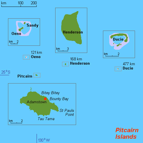
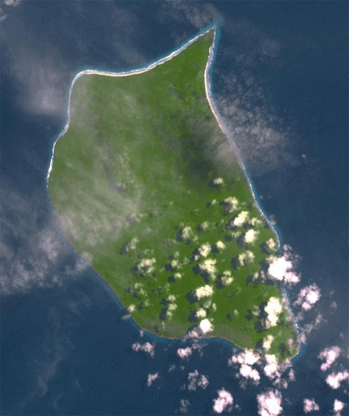
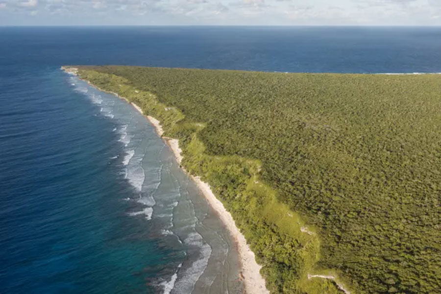
Henderson Island (formerly also San Juan Bautista and Elizabeth Island) is an uninhabited island in the south Pacific Ocean. It is part of the Pitcairn Island Group. Measuring 9.6 by 5.1 kilometres , it has an area of 37.3 km2 and is located 193 km northeast of Pitcairn Island. It has poor soil and little fresh water, and is unsuitable for agriculture. There are three beaches on the northern end and the remaining coast comprises steep (mostly undercut) cliffs up to 15 m in height. In 1902, it was annexed to the Pitcairn Islands colony, which is now a British Overseas Territory. Henderson is one of the last two raised coral atolls in the world whose ecosystems remain relatively unaffected by human contact, along with Aldabra in the Indian Ocean. In 1988, it was designated a World Heritage Site by the United Nations. Ten of its 51 flowering plants, all four of its land birds and about a third of the identified insects and gastropods are endemic – a remarkable diversity given the island's size.
The island was settled by Polynesians — possibly as early as 800 AD — but by the 1600s it had been abandoned. The reasons for the inhabitants’ disappearance remain uncertain, but they may relate to an exhaustion of resources and to the disappearance around the same time of the Polynesians on Pitcairn Island, on whom those on Henderson would have relied for many of the basics of life, especially for the stone needed to make tools. The Pitcairn Polynesians may in turn have disappeared because of the decline of nearby Mangareva; thus, Henderson was at the end of a chain of small, dependent colonies of Mangareva.
1606, Portuguese captain Pedro Fernandes de Queirós, leading a Spanish expedition in search of the fabled great south land (Terra Australis), was the first European to see the island, and named it San Juan Bautista. More than 200 years later, on 17 January 1819, Captain Henderson of the British East India Company ship Hercules rediscovered the island. Six weeks later, on 2 March 1819, Captain Henry King, in the Elizabeth, landed on the island to find the king's colours already flying. His crew scratched the name of their ship into a tree, and for a while the island was known as both Elizabeth and Henderson Island.
1820, a sperm whale rammed and sank the Nantucket whaleship Essex (a report of which inspired Herman Melville to write Moby-Dick), and the ship's 20 crewmen arrived at Henderson on 20 December in three small whaleboats. They found the island's only known drinkable water source – a brackish spring on the north shore, exposed at half tide – and ate fish, birds, eggs, crabs and peppergrass, but within a week they had largely exhausted the readily available food. Therefore, on 27 December, the three boats set sail for South America, leaving behind Thomas Chappel, Seth Weeks and William Wright who chose to stay and survived until their rescue several months later, on 9 April 1821.
1902, Henderson Island, along with Oeno and Ducie islands, was formally annexed to the British Empire by Captain G. F. Jones, who visited the islands in a cutter with a crew of Pitcairn Islanders. In August 1937, HMS Leander, on a journey from Europe to New Zealand, carried out an aerial survey of Henderson, Oeno and Ducie, and, on each island, a British flag was planted and an inscription was nailed up proclaiming: "This island belongs to H.B.M. King George VI".
1957, a 27-year-old American, Robert Tomarchin, lived the life of a castaway on the island for approximately two months, accompanied by a pet chimpanzee, apparently as a publicity stunt, until people from Pitcairn rescued him in two longboats. In the early 1980s, the American businessman Arthur "Smiley" Ratliff expressed interest in establishing a mansion for himself on the island, with an airstrip. The Pitcairn Island Council approved his plans but, after environmentalists lobbied to protect the natural ecology and environment of the island, the British Foreign and Commonwealth Office overrode the decision and vetoed the proposed development. Henderson Island was listed as a World Heritage Site in 1988.
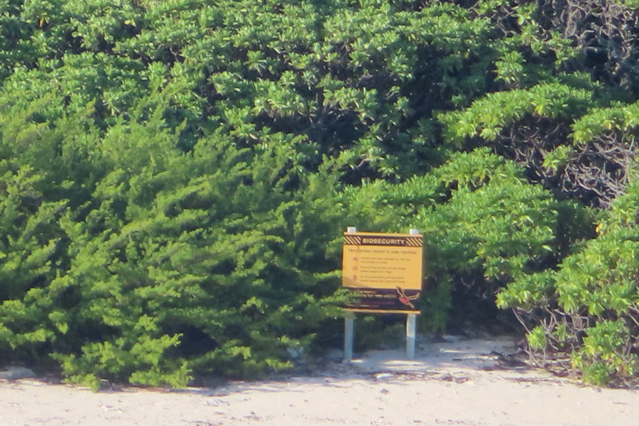
Between July and November 2011 a partnership of the Pitcairn Islands Government and the Royal Society for the Protection of Birds implemented a poison baiting programme aimed at eradicating the Pacific rat. Mortality was massive but of the 50,000 to 100,000 population, 60 to 80 individuals survived and the population has now fully recovered
.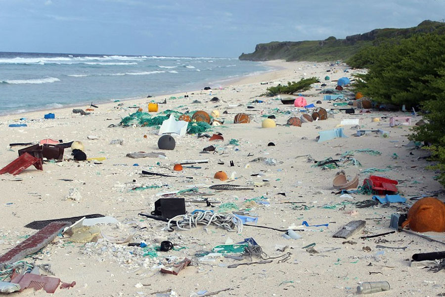
Research published in April 2017 looked at debris on several beaches, and reported "the highest density of plastic rubbish anywhere in the world" as a result of the South Pacific Gyre. The beaches contain an estimated 37.7 million items of debris together weighing 17.6 tonnes. In a study transect on North Beach, each day 17 to 268 new items washed up on a 10-meter section. The study noted that purple hermit crabs (Coenobita spinosus) make their homes in plastic containers washed up on beaches, and the debris may reduce shoreline gastropod diversity, may contribute to a reduction in the number of sea turtle laying attempts and may increase the risk of entanglement for coastal-nesting seabirds. In June 2019, an expedition organised by the UK Government attempted to remove some of the plastic debris from the island's East beach. The team collected six tonnes of rubbish, but weather conditions hampered efforts to take the rubbish off the island. A further expedition, planned for April 2020, was delayed because of the COVID-19 pandemic. In 2019, a group of scientists, journalists, film makers, and artists took part in an expedition to Henderson Island to investigate plastic pollution and marine litter on the island. Five members of the expedition became stranded on the island when their inflatable craft capsized.
In March 2022 a Royal Navy survey by HMS Spey, as part of an effort to update maritime charts regarding British Overseas Territories, found the island to be 1 mile south of its indicated position. The existing data dates to an aerial survey in 1937, indicating a calculation error when the chart was produced.
click on a thumbnail to get a bigger photo
 |
 |
 |
 |
April 1st
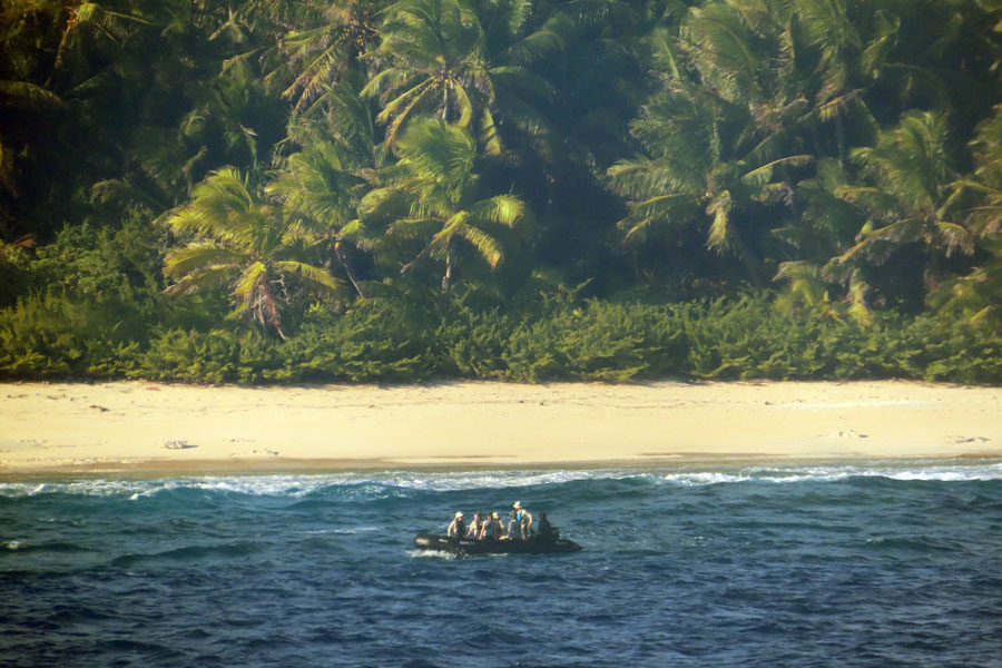
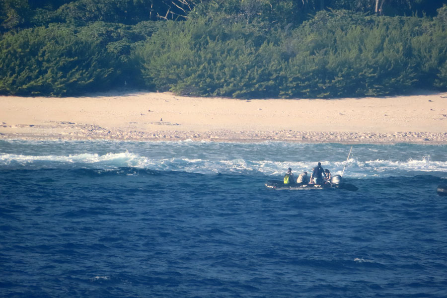
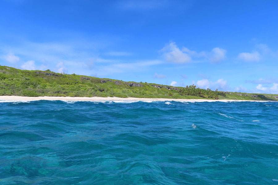
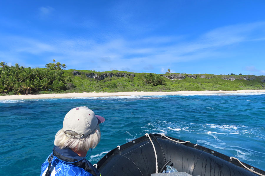
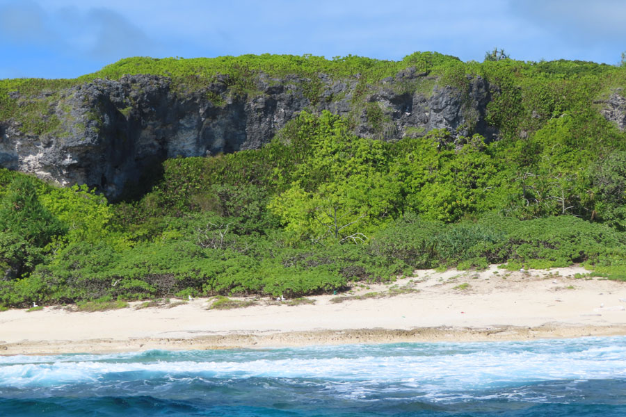
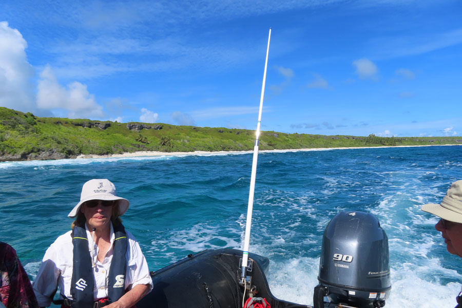
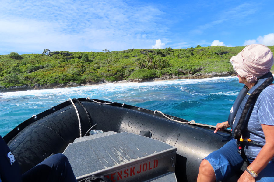
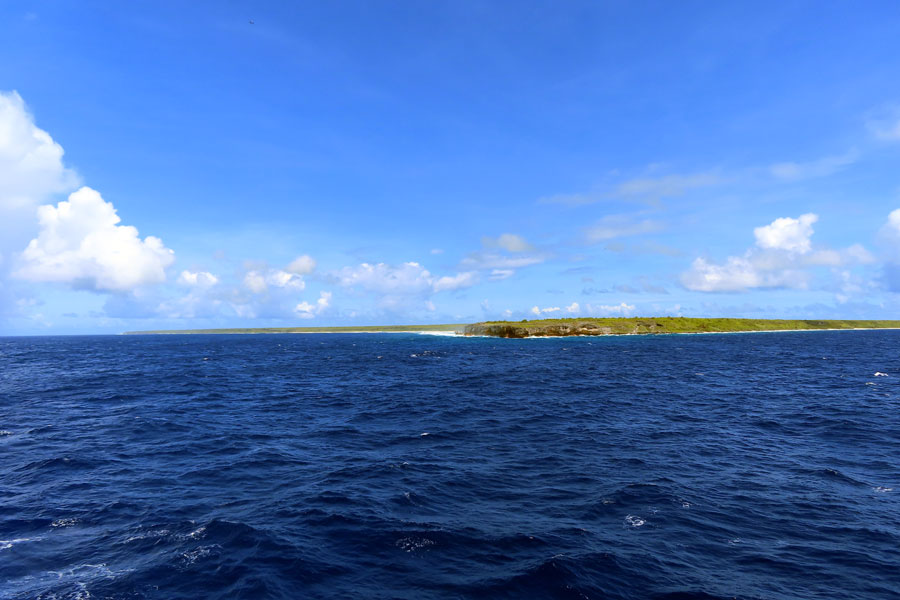
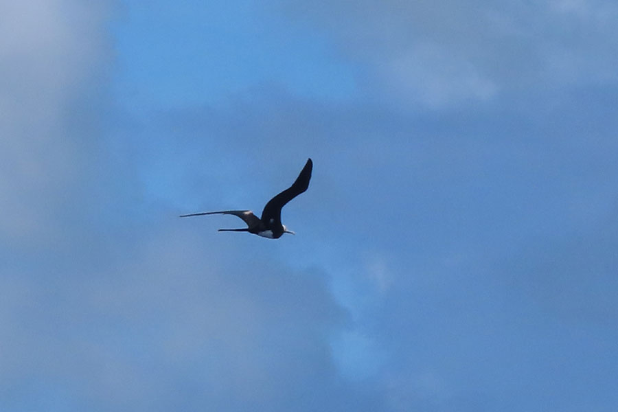
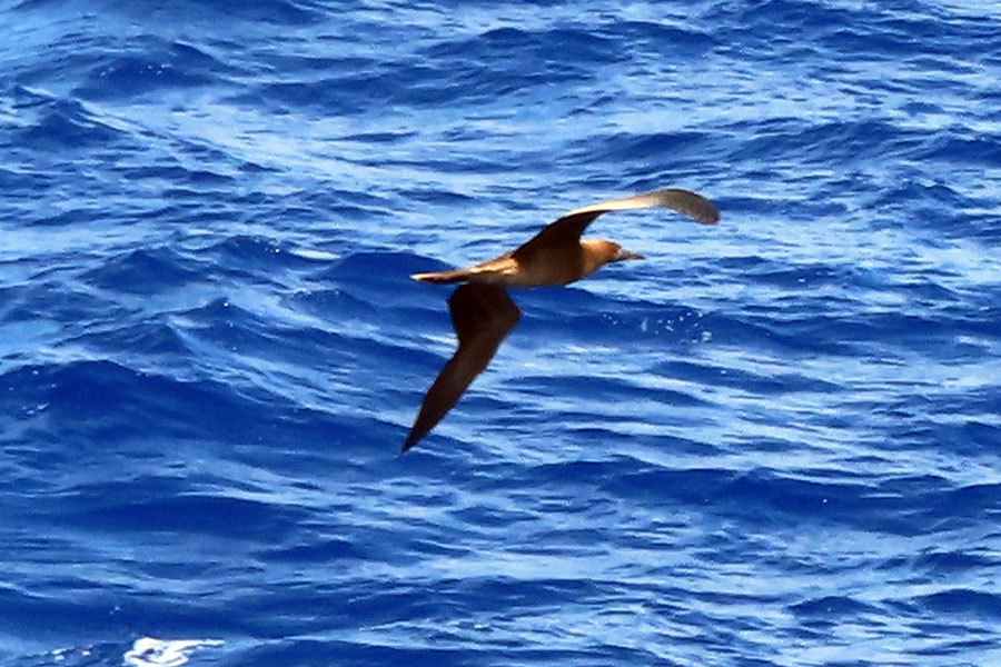
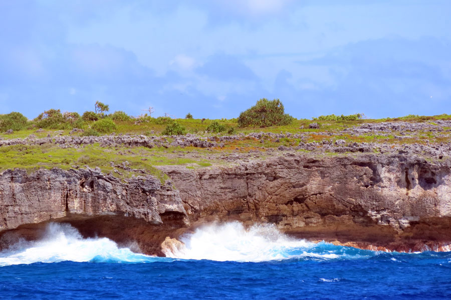
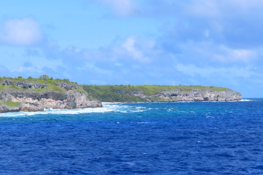
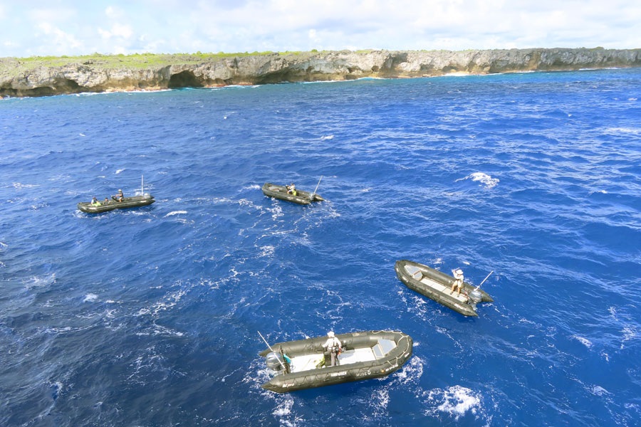
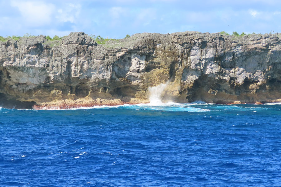
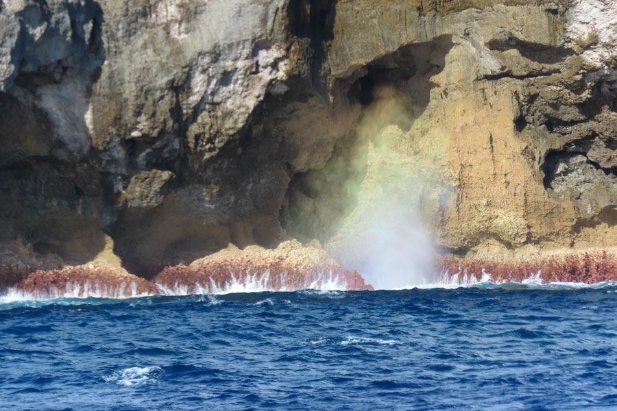
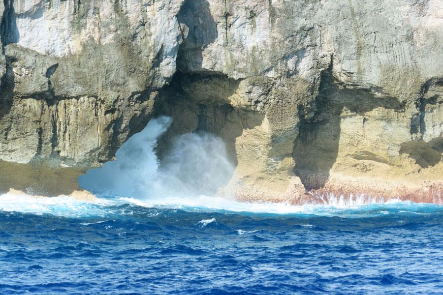
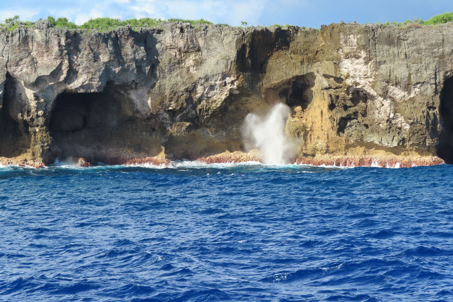
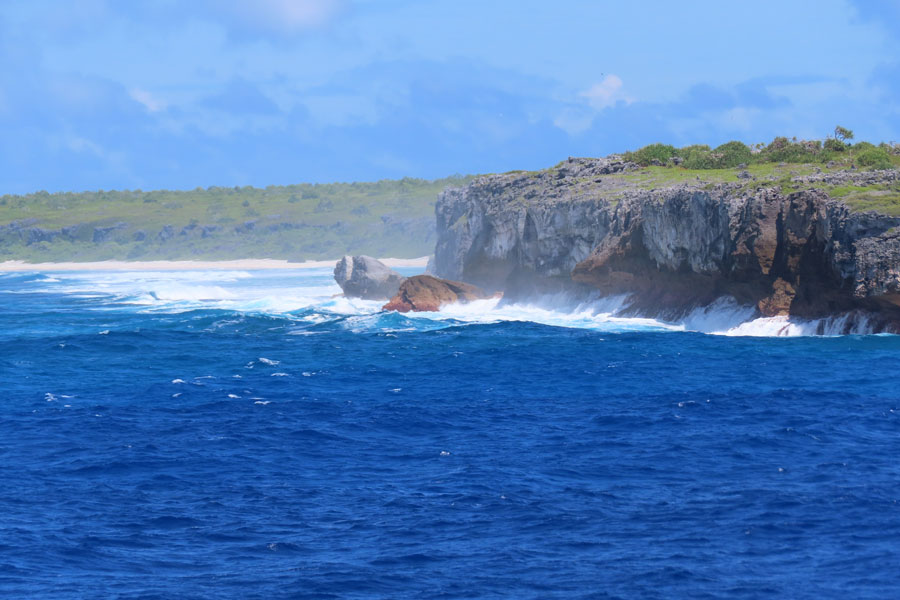
Arrived at Henderson Island by soon after 07.00 and the expedition staff went out to scout out an opening in the reef to get us onto land. They reported back by 9 that they could not find one; still too much swell although far less than yesterday and bright sunshine. So we had a 75 minute zodiac cruise instead. Damon was our driver and he told us how he and Lea had snorkeled at the possible gaps through the reef to find a safe passage for the zodiacs, but had eventually been called back by the captain. Got a good view of the cliffs and the odd booby ashore. It would have been a good beach to walk along.
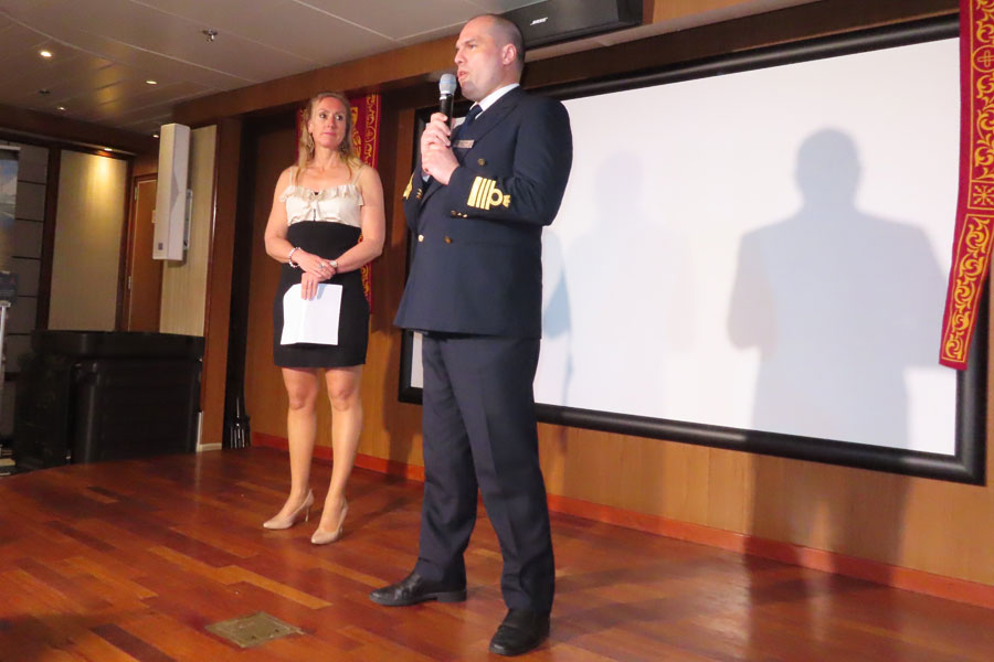
Returned moderately wet!. Had bouillon in the Panorama lounge and then lunch up on deck, somewhat windy. The afternoon snorkeling had already been cancelled but now they said they were scouting for a different opening in the reef. This also unsuccessful - as we well knew as the swell had increased! - and replaced by another zodiac cruise along a different shore of cliffs. Not many went down for it and indeed it was also called off - too dangerous; we await Marieke's long winded explanation of how hard she tried to make it all happen!! 6 minutes!! Why does she do it??
Instead the Captain circumnavigated the island in the afternoon, so we probably saw more than we would have done from a Zodiac
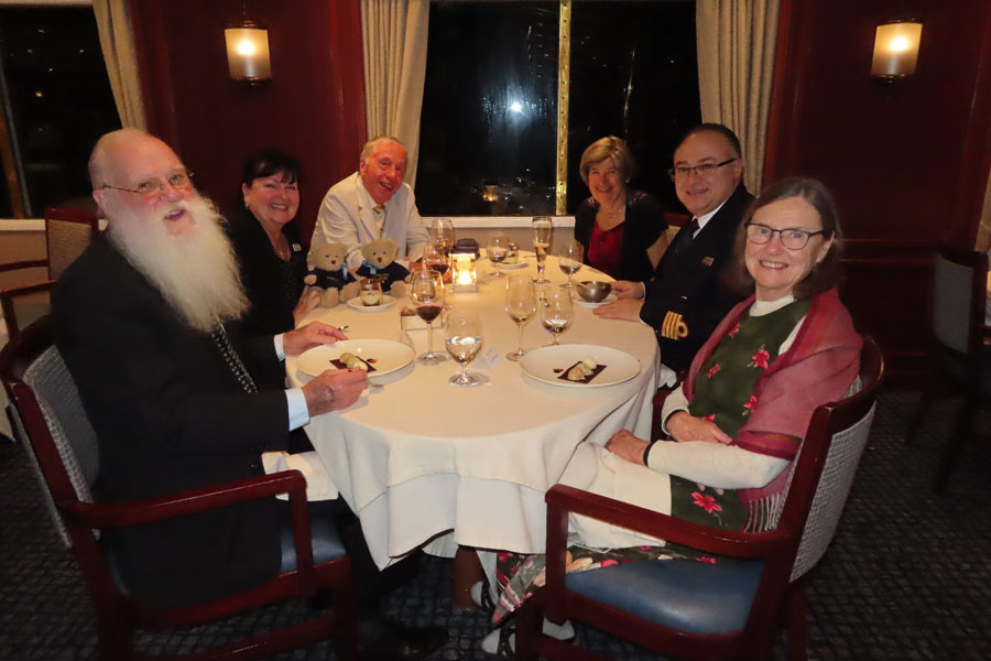
Then our much beloved canapés, pisco sour and an Indonesian themed dinner
click on a thumbnail to get a bigger photo
 |
 |
 |
 |
 |
 |
 |
 |
 |
 |
 |
 |
 |
 |
 |
 |
 |
 |
 |
 |
Explorer from Punta Arenas to Papeete